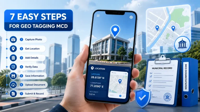
Geotagged Photos Add Capture Find and Remove GPS Location Data
A Geotagged Photos can contain much more information than what you see on the screen. Along with the visible image, a photograph may store details such as the camera model, capture date, time, and GPS coordinates. This location information is commonly known as Geotagged Photos.
Whether you want to organize travel memories, document property inspections, record field visits, or add location information to an existing photograph, understanding how geotagging works can make your workflow much easier.
Modern smartphones can automatically save location information when camera location permissions are enabled. Dedicated GPS camera apps can also display coordinates, addresses, maps, dates, and timestamps directly on photographs.
In this guide, you’ll learn how to capture location-aware photos, add GPS information to existing pictures, find GPS coordinates from photographs, and remove location data when privacy matters.
What Is Photo Geotagging?
Geotagged Photos is the process of associating an image with geographic location information.
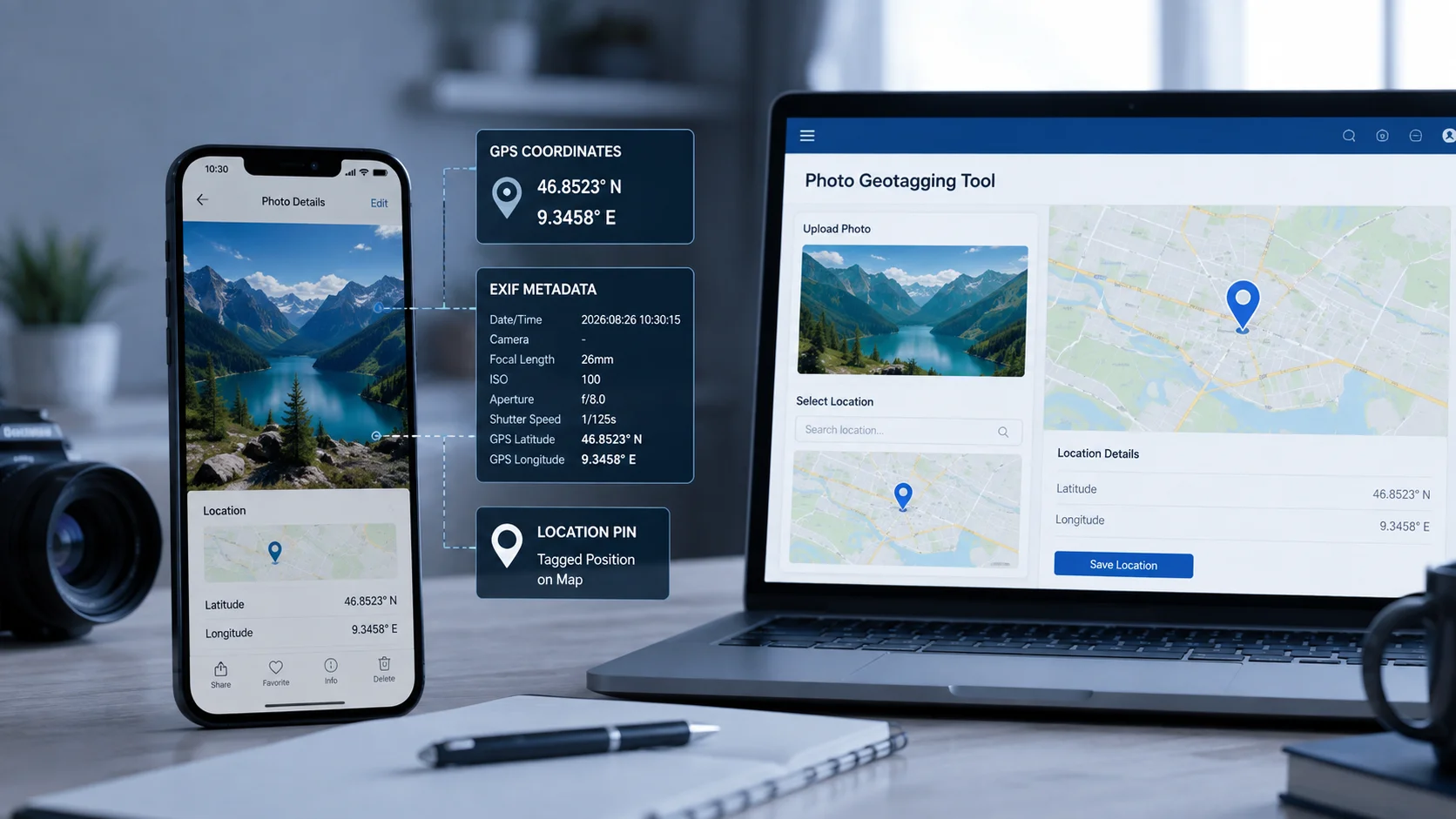
The location is commonly stored inside the image’s EXIF metadata. EXIF can contain GPS latitude and longitude along with other technical information about the photograph.
For example, a photograph taken at a property could contain GPS coordinates identifying the approximate location where the camera was used.
This information can be useful for:
- Travel photography
- Property documentation
- Construction inspections
- Field research
- Agriculture
- Delivery verification
- Surveying
- Local business photography
- Personal photo organization
A key point is that GPS information and a visible location stamp are not necessarily the same thing. Some applications write GPS coordinates into EXIF metadata, while GPS camera applications may additionally place the address, map, date, or coordinates visibly on the photograph.
How Can You Capture Location-Enabled Photos on a Mobile?
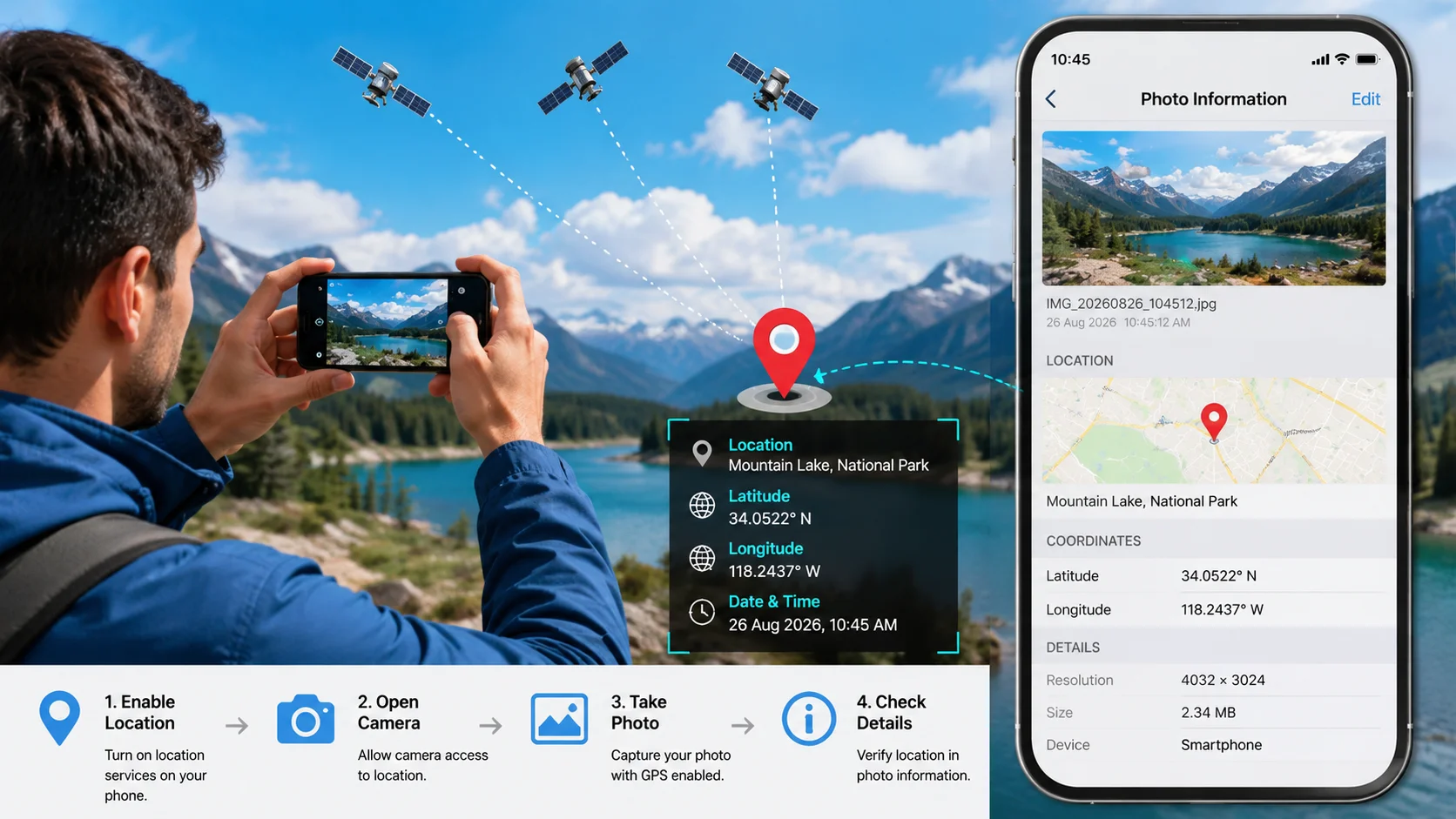
The easiest way is usually to use your smartphone’s built-in camera with location services enabled.
On many phones, the general process is:
- Open your phone’s Settings.
- Enable Location Services.
- Give the camera permission to access your location.
- Open the Camera application.
- Take a photograph outdoors or in a location where GPS reception is available.
- Open the photograph’s information or details panel.
- Check whether location information has been saved.
The exact settings vary between Android and iPhone devices.
Another option is a dedicated GPS camera application. Several current apps are designed to capture photographs with GPS coordinates, addresses, timestamps, maps, altitude, or compass information.
If your goal is simply to preserve location information in the file, a normal smartphone camera with appropriate location permissions may be enough. If you need a visible map, address, or timestamp on the photograph, a specialized GPS camera application can provide additional features.
Which App Is Used to Take Geotagged Photos?
There isn’t one universal app that everyone must use. The best choice depends on whether you want hidden GPS metadata, a visible location stamp, or both.
GPS camera applications available today can automatically record latitude and longitude and may also show addresses, maps, date, time, weather, altitude, and other information.
When choosing an app, consider:
- GPS accuracy
- Android or iOS compatibility
- EXIF support
- Offline functionality
- Privacy policies
- Visible map and address stamps
- Ability to edit existing photographs
- Export and sharing options
For professional work, privacy is particularly important. Some tools process photographs locally on the device, while others may upload images to remote servers. Always check how an application handles your photographs before using it for sensitive property, business, or personal documentation.
How to Add GPS Location to Existing Photos
What if you already took a photograph but it doesn’t contain location information?
You can manually add coordinates using an online geotagging tool or desktop application.
The general workflow for Geotagged Photos is straightforward:
Upload or select the photograph → choose a location → confirm the coordinates → save the updated image.
Browser-based tools can allow you to select a location using a map, search for a place, or enter latitude and longitude manually. Some modern tools write the coordinates into EXIF metadata while processing the image locally in the browser.
This is particularly useful for photographs captured by:
- Older digital cameras
- Screenshots
- Scanned photographs
- Cameras without GPS
- Images where metadata was removed
- Photos exported through services that strip metadata
Before adding a location, make sure the coordinates actually represent the place where the photograph was taken. Adding incorrect coordinates can create misleading information.
How to Get GPS Location From a Photo
If you have received a photograph and want to know where it was taken, first check whether the file contains GPS metadata.
On compatible devices, open the photograph’s information or details panel. If GPS data is available, the device or photo application may display a map or location.
You can also use an EXIF metadata viewer. These tools can inspect fields such as:
- Latitude
- Longitude
- GPS altitude
- Date and time
- Camera manufacturer
- Camera model
- Lens information
However, not every photograph contains GPS information. Social media platforms, messaging applications, image editors, and other services may remove metadata during processing.
If the original file has already lost its GPS information, an EXIF viewer cannot magically recover the original coordinates. You would need another source of location information, such as the original device, photo history, travel records, or manually known coordinates.
How to Remove Location Information From a Photograph
Geotagged Photos can be useful, but it can also create privacy concerns.
A photograph taken outside your home may contain coordinates that reveal exactly where the picture was captured. Before publicly sharing photographs, consider whether you actually want the location information attached.
To remove location metadata, you can use an EXIF metadata remover or privacy-focused image tool.
A typical process is:
- Select the photograph.
- Inspect its metadata.
- Remove GPS fields or all EXIF information.
- Save or export a new copy.
- Check the new file to confirm that the location data has been removed.
If you are sharing photographs publicly, removing GPS information can be especially useful for private residences, children, workplaces, or other sensitive locations.
Can You Geotagged Photos Online for Free?
Yes. Browser-based services can let users add coordinates to photographs without installing traditional desktop software.
Some online geotagging tools allow you to upload an image, select a location on a map, and download a new version containing GPS metadata. Other privacy-focused tools process the photograph directly inside your browser so the original file does not need to be sent to a server.
When using any online service, check:
- Whether your image is uploaded
- Whether files are stored
- Maximum file size
- Supported image formats
- Whether EXIF data is preserved
- Whether the tool supports batch processing
For private or sensitive photographs, local browser processing can be preferable because the original image remains on your device.
Geotagging vs GPS Stamp What’s the Difference?
These terms are often used interchangeably, but there is an important distinction.
Geotagging generally means storing geographic information with the photograph, often through EXIF metadata.
A GPS stamp usually refers to visible information placed directly on the image, such as:
Latitude: 24.8607
Longitude: 67.0011
Karachi, Pakistan
26 August 2026
A GPS camera app may provide both features at the same time: hidden EXIF coordinates plus visible location information.
Why Are Location-Aware Photos Useful?
Location information can make photographs easier to organize and verify.
For travelers, it can help create a location-based record of a trip. For property professionals, it can connect photographs with specific sites. Construction teams can use location information when documenting project progress, while field workers can use GPS-enabled photographs as evidence of visits.
However, location metadata should always be handled responsibly. A useful location tag can become a privacy risk when shared publicly without considering who can access it.
Final Thoughts
Location information can make photographs more useful, searchable, and easier to organize. Whether you’re documenting a property, recording a field visit, preserving travel memories, or checking where an image was captured, understanding GPS metadata gives you more control over your photos.
You can capture location-aware photographs directly from a mobile device, add coordinates to existing files with online tools, inspect EXIF information to find available GPS data, or remove location metadata before sharing.
The most important rule is simple: add location data when you need it, and remove it when privacy matters.
Frequently Asked Questions
1. Which app is used to take geotagged photos?
You can use your phone’s standard camera if location permissions are enabled, or choose a dedicated GPS camera application. Specialized apps can provide additional features such as visible coordinates, addresses, maps, timestamps, altitude, and compass information.
2. How can I remove a geotag from a photo online for free?
Use an EXIF metadata removal tool that can delete GPS fields from the image. After processing, inspect the resulting file to verify that the location information has been removed. For sensitive photographs, choose a service that clearly explains how it processes and stores uploaded files.
3. How do I capture geotagged photos on mobile?
Enable your phone’s Location Services and allow the camera to access your location. Take the photograph while GPS reception is available, then check the photo’s details to confirm that location information was recorded.
4. How do I get GPS location from a photo?
Check the photograph’s EXIF metadata using your phone’s photo details or an EXIF viewer. If GPS information exists, you may see latitude, longitude, or a map. If the metadata was removed, the original location may not be recoverable from the image alone.
5. Can I add location information to an existing photograph?
Yes. Online geotagging tools and desktop applications can allow you to select a location and write GPS coordinates into supported image metadata. You can typically choose a map position, search for a place, or enter coordinates manually.
6. Are geotagged photos safe to share online?
They can be, but you should consider privacy first. GPS metadata may reveal where a photograph was taken. Before publicly sharing personal or sensitive images, inspect the metadata and remove location information if revealing the location could create a privacy or security concern.